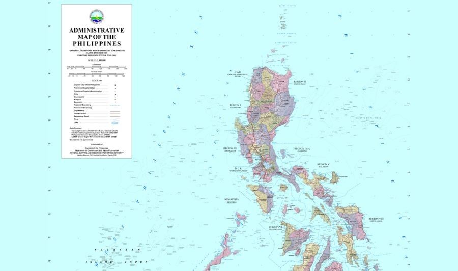
MANILA – The National Mapping and Resource Information Authority (NAMRIA) clarified that the West Philippine Sea has been consistently labeled on official Philippine maps since 2012, countering claims that the area lacks coordinates or does not exist on government maps.
In a statement, NAMRIA said its administrative, topographic, thematic, and nautical charts — all produced under Administrative Order 29 signed by then-President Benigno Aquino III — carry the West Philippine Sea label in accordance with government policy.
“Since 2012, the Philippines has formally used the name West Philippine Sea in government publications,” NAMRIA said. “In accordance with this policy, NAMRIA places the label consistently across its official maps and charts.”
NAMRIA addressed claims that the West Philippine Sea has no coordinates, explaining that the country’s exclusive economic zone (EEZ) extends up to 200 nautical miles from its archipelagic baselines, creating a continuous curved boundary rather than a polygon with fixed points.
“Because of this, a short list of coordinates would not accurately describe the maritime limit,” the agency said, noting that precise geospatial data based on Republic Act 9522’s archipelagic baselines is used by navigation systems and mapping software to compute maritime limits correctly.
NAMRIA added that its nautical charts follow international hydrographic standards, are used by Philippine and foreign vessels, and are submitted to the International Hydrographic Organization to integrate Philippine maritime data into global records.
The statement directly responded to remarks by Senator Rodante Marcoleta, who on February 3 and 4 suggested the West Philippine Sea may not have defined coordinates and even questioned Philippine claims over the Kalayaan Island Group. Similar claims by Marcoleta in February 2025 sparked earlier debates.
Retired Supreme Court Senior Associate Justice Antonio Carpio has previously clarified that under UNCLOS, coastal states are not required to publish EEZ coordinates for their limits to be legally valid. Philippine EEZ boundaries flow automatically from baselines established under RA 9522, Carpio said, citing the 1969 North Sea Continental Shelf cases and Articles 76 and 77 of UNCLOS.
The clarification comes amid rising tensions between Manila and Beijing following the appointment of a new Chinese ambassador in late 2025, with disputes escalating over remarks by Philippine officials, satirical presentations, and diplomatic protests.
Republic Act 12064, signed in November 2024, formally defines the West Philippine Sea as the Philippines’ maritime zones on the western side of the archipelago, including the territorial sea, EEZ, and maritime features such as Bajo de Masinloc and the Kalayaan Island Group.


Leave a comment