MANILA— The Philippine Space Agency (Philippine Space Agency) is reviewing satellite imagery related to the 7.8-magnitude earthquake that struck southern Mindanao on June 8, 2026, which has shown evidence of earthquake-triggered landslides in several areas.
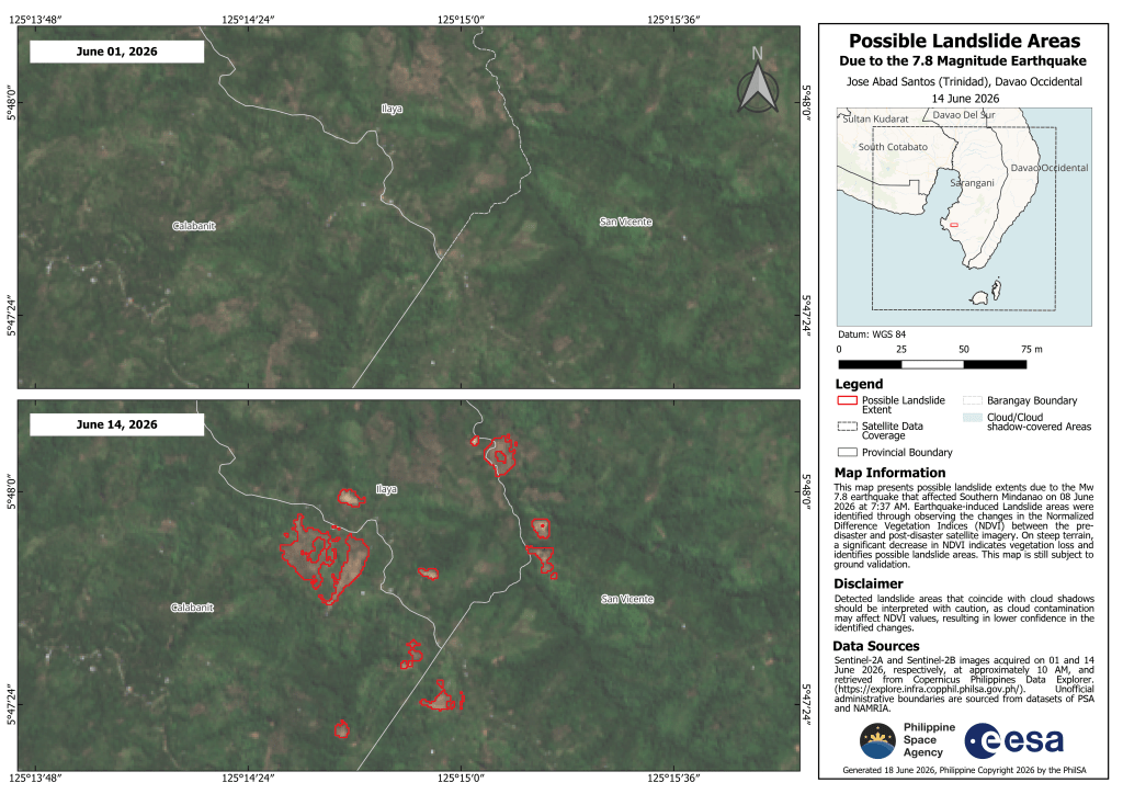
Based on maps produced by PhilSA, landslide-affected areas were identified in barangays Calabanit, Ilaya, San Vicente, Congan, and Calpidong in Glan, Sarangani, as well as barangays Butuan, Patulang, Sugal, Nuing, San Isidro, and Batulan in Jose Abad Santos, Davao Occidental. The total area possibly impacted by landslides is estimated at 137.87 hectares (about 1.38 square kilometers), equivalent to more than half the size of Bonifacio Global City.
The assessment was derived from comparisons of satellite images taken before and after the disaster, specifically from June 1 and June 14, 2026, captured by Sentinel-2A and Sentinel-2B satellites of the European Space Agency. Areas that previously appeared vegetated were observed to have shifted to exposed soil conditions, indicating potential landslide zones. The changes were measured through a significant decline in the Normalized Difference Vegetation Index (NDVI), an indicator used to assess vegetation cover.
PhilSA said the identified areas remain subject to ground validation to confirm the satellite-based findings.
The agency added that its satellite monitoring supports the National Disaster Risk Reduction and Management Council (National Disaster Risk Reduction and Management Council) by providing wide-area assessments that help identify priority locations for response operations.
PhilSA said it will continue to monitor satellite data as conditions develop and advised the public to follow updates from relevant local and national authorities for official advisories.


Leave a comment