
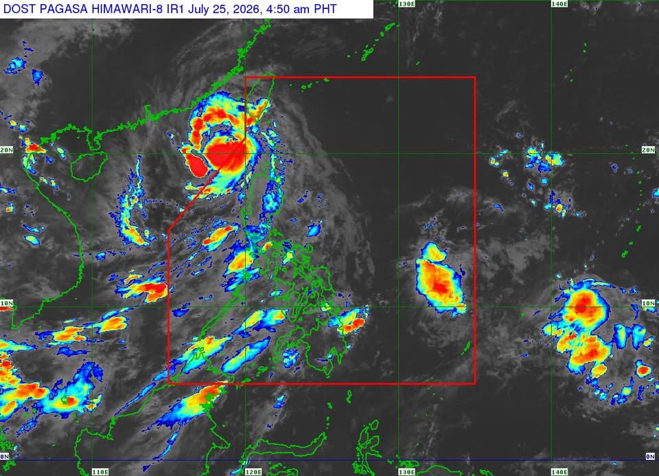
MANILA — Typhoon Kiyapo rapidly intensified and exited the Philippine Area of Responsibility (PAR) early Saturday, but continues to enhance the southwest monsoon, bringing strong winds, heavy rains, and rough seas over parts of the country, the state weather bureau said.
In its 5 a.m. tropical cyclone bulletin, the Philippine Atmospheric, Geophysical and Astronomical Services Administration (PAGASA) said the center of Typhoon Kiyapo was estimated at 320 kilometers west of Basco, Batanes, outside PAR.
The typhoon packs maximum sustained winds of 120 kilometers per hour (kph) near the center, gusts of up to 150 kph, and is moving west northwestward at 25 kph. Strong to typhoon-force winds extend up to 470 kilometers from the center.
Tropical Cyclone Wind Signal (TCWS) No. 1 remains in effect over Batanes, the western portion of the Babuyan Islands, the northwestern portion of mainland Cagayan, the northern portion of Apayao, and Ilocos Norte.
PAGASA said minimal to minor impacts from strong winds remain possible in areas under TCWS No. 1.
Despite Kiyapo’s exit from PAR, the southwest monsoon and the typhoon’s circulation are expected to bring strong to gale-force gusts over most of Luzon, Western Visayas, the Negros Island Region, Northern Samar, Zamboanga del Norte, and Davao Oriental on Saturday.
A gale warning also remains in effect over the northern seaboard of Northern Luzon.
PAGASA warned of very rough seas of up to 4.5 meters along the seaboards of Batanes, the Babuyan Islands, and the northern coast of Ilocos Norte, where sea travel remains risky for all types of vessels. Mariners were advised to remain in port or seek safe harbor until sea conditions improve.
Rough seas of up to 3.5 meters are also forecast over the northeastern seaboard of Cagayan, while waves of up to 3 meters are expected along the remaining coastal waters of Ilocos Norte and Cagayan.
The weather bureau said Kiyapo is forecast to continue moving generally northwestward toward southern mainland China before turning north northwestward. It is expected to strengthen further over the next 12 hours before making landfall in southern China, after which it is forecast to weaken rapidly as it moves inland.
PAGASA advised the public and local disaster risk reduction and management offices to continue taking precautionary measures against possible heavy rainfall, strong winds, and other hazards associated with the typhoon and the southwest monsoon.




 Republika News
Leave a comment