
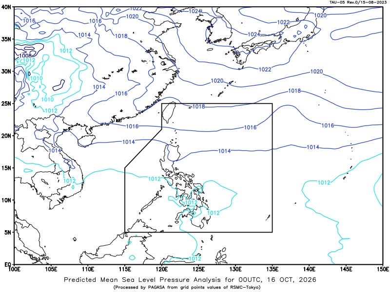
MANILA— The Intertropical Convergence Zone (ITCZ) is expected to bring scattered rains and thunderstorms over Visayas, Mindanao, the Bicol Region and MIMAROPA on Friday, with possible flash floods and landslides due to moderate to at times heavy rainfall, according to the Philippine Atmospheric, Geophysical and Astronomical Services Administration (PAGASA).
In its 4 a.m. weather forecast on Oct. 16, PAGASA said the ITCZ is also affecting Palawan, Visayas and Mindanao.
Aurora and Quezon will likewise experience cloudy skies with scattered rains and thunderstorms due to the easterlies, with moderate to occasionally heavy rains potentially triggering flash floods and landslides.
Metro Manila and the rest of Luzon will have partly cloudy to cloudy skies with isolated rain showers or thunderstorms, also due to the easterlies. Severe thunderstorms may cause flash floods or landslides.
Meanwhile, Batanes and the Babuyan Islands will experience partly cloudy to cloudy skies with isolated light rains due to the northeasterly windflow, with no significant impact expected.
PAGASA said moderate winds from the northeast to east will prevail over extreme Northern Luzon, where coastal waters are forecast to range from moderate to rough, with wave heights of 1.5 to 2.5 meters.
The rest of Luzon and Visayas will experience light to moderate winds from the northeast to east, with slight to moderate coastal waters and wave heights of 0.6 to 2.1 meters.
In Mindanao, light winds with variable directions and slight coastal waters, with wave heights of 0.6 to 1.2 meters, are expected.
PAGASA recorded a minimum temperature of 23.8 degrees Celsius at 6 a.m. and a maximum of 33.2 degrees Celsius at 3 p.m. during the 24-hour period ending at 8 p.m. on Thursday.
Relative humidity ranged from a minimum of 51% at 2 p.m. to a maximum of 94% at 6 a.m.
In Metro Manila, sunrise is expected at 5:48 a.m. and sunset at 5:36 p.m. The moon is forecast to rise at 10:26 a.m. and set at 9:46 p.m., with 30% illumination.






Leave a Reply