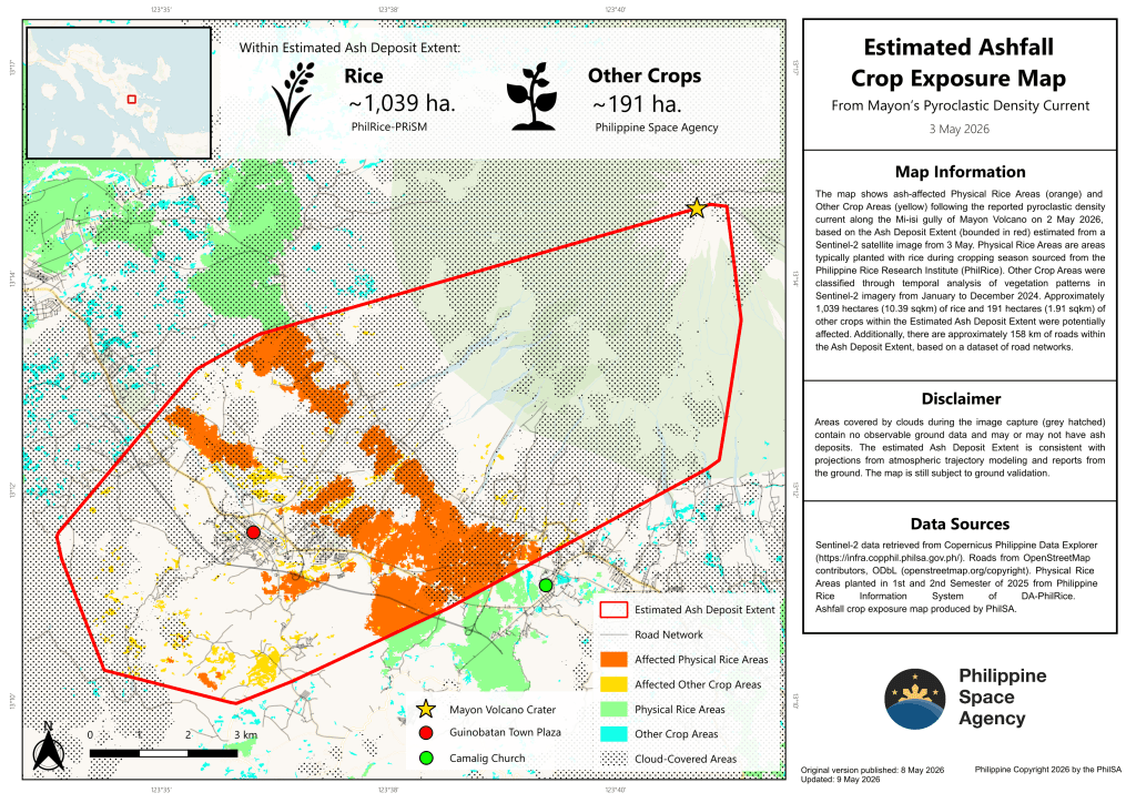
MANILA — The Philippine Space Agency (PhilSA) has released a crop exposure map showing agricultural areas potentially affected by ashfall following a reported pyroclastic density current along the Mi-isi gully of Mayon Volcano on May 2, 2026.
The map identified ash-affected Physical Rice Areas and Other Crop Areas after overlaying agricultural and satellite data within the estimated ash deposit extent.
According to PhilSA, at least 1,039 hectares (10.39 sq km) of rice fields and 191 hectares (1.91 sq km) of other crops may have been affected, based on their location within the red-delineated ash deposit zone. The combined affected agricultural area is comparable in size to Mandaluyong City.
Physical Rice Areas were sourced from the Philippine Rice Research Institute under the Department of Agriculture, while Other Crop Areas were classified using vegetation changes detected through Sentinel-2 satellite imagery from January to December 2024.
PhilSA also noted that around 158 kilometers of roads fall within the estimated ash deposit extent, based on road network datasets.
However, the agency said cloud cover during satellite image capture limited full observation of ground conditions in some areas, which were marked as cloud-covered zones and may still contain ash deposits or unaffected land.
The estimated ash extent is consistent with atmospheric trajectory models and ground reports, but PhilSA stressed that the map remains subject to field validation.
PhilSA said its satellite-based analysis supports the National Disaster Risk Reduction and Management Council (National Disaster Risk Reduction and Management Council) by providing wide-area monitoring to help prioritize response efforts.
It added that making space-based data accessible to agencies strengthens disaster preparedness, response, and decision-making in affected communities.


Leave a comment