
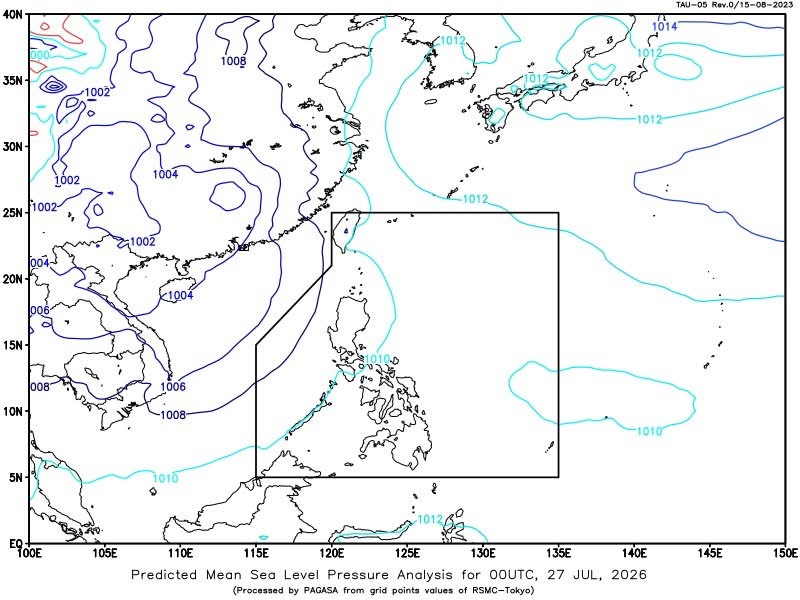
MANILA – The southwest monsoon (habagat) continues to affect Luzon, bringing cloudy skies, scattered rains and thunderstorms over several areas, while Tropical Depression Noul (formerly “Kiyapo”) has moved outside the Philippine Area of Responsibility (PAR), the state weather bureau said Monday.
In its 4 a.m. weather bulletin, PAGASA said Tropical Depression Noul was last spotted 1,015 kilometers west northwest of Extreme Northern Luzon, packing maximum sustained winds of 55 kilometers per hour (kph), gusts of up to 90 kph, and moving north northwestward at 20 kph.
Despite the cyclone’s exit from PAR, the southwest monsoon continues to bring cloudy skies with scattered rains and thunderstorms over Metro Manila, the Ilocos Region, Cagayan Valley, Cordillera Administrative Region, MIMAROPA, Zambales, Bataan, Bulacan, Cavite, Laguna and Batangas.
PAGASA warned that moderate to at times heavy rains may trigger flash floods or landslides in affected areas.
The rest of Luzon will experience partly cloudy to cloudy skies with isolated rain showers or thunderstorms due to the southwest monsoon, while the rest of the country will have similar weather conditions caused by localized thunderstorms. Flash floods or landslides remain possible during severe thunderstorms.
Meanwhile, moderate southwesterly to southerly winds will prevail over the western section of Luzon, with moderate coastal waters ranging from 1.5 to 2.5 meters.
The rest of Luzon will experience light to moderate winds from the south to southeast, with slight to moderate seas of 0.6 to 1.8 meters.
Light to moderate south to southwesterly winds will also prevail over the Visayas and Mindanao, where coastal waters will remain slight to moderate with wave heights of 0.6 to 1.5 meters.
PAGASA advised the public to remain alert for possible flooding and landslides, particularly in areas experiencing prolonged or heavy rainfall.





Leave a Reply