
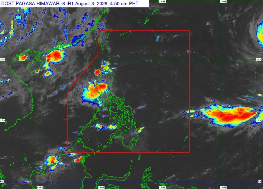
MANILA – Tropical Depression Luis maintained its strength while remaining almost stationary over the sea east of Aurora early Monday, prompting the continued implementation of Tropical Cyclone Wind Signal (TCWS) No. 1 over several areas in Northern Luzon, according to the Philippine Atmospheric, Geophysical and Astronomical Services Administration (PAGASA).
In its 5 a.m. tropical cyclone bulletin, PAGASA said the center of Luis was estimated at 130 kilometers east-southeast of Casiguran, Aurora, based on all available data.
The tropical depression packs maximum sustained winds of 55 kilometers per hour near the center, with gusts reaching up to 70 kph. It has a central pressure of 1002 hectopascals, while strong winds extend up to 240 kilometers from its center.
TCWS No. 1 remains in effect over the central and eastern portions of Cagayan, Isabela, Quirino, the eastern and southern portions of Apayao, the eastern portion of Kalinga, the eastern portion of Mountain Province, the eastern portion of Ifugao, the northern portion of Aurora, the Polillo Islands, and the northern portion of Camarines Norte.
Under TCWS No. 1, wind speeds ranging from 39 to 61 kph are expected within 36 hours, with minimal to minor threats to life and property.
PAGASA also warned of possible minimal to minor impacts from strong winds in areas under the wind signal, noting that coastal and mountainous areas exposed to prevailing winds may experience stronger conditions.
Meanwhile, the southwest monsoon enhanced by the periphery of Luis is expected to bring strong to gale-force gusts over most of Luzon and the Visayas today and Tuesday, as well as parts of Northern and Eastern Mindanao. Similar conditions are forecast on Wednesday over most of Luzon and the Visayas, the Zamboanga Peninsula, Northern Mindanao, Dinagat Islands, Surigao del Norte, Agusan del Norte, Davao Occidental, and Davao Oriental.
PAGASA advised mariners of motorbancas and similarly sized vessels to exercise caution or avoid sailing in areas where moderate to rough seas are expected.
Wave heights of up to 2.5 meters are forecast along the eastern seaboard of Isabela and Davao Oriental, as well as the northeastern seaboard of Aurora. Seas of up to 2 meters are also expected over several coastal waters, including the seaboards of Batanes, the Babuyan Islands, mainland Cagayan, Pangasinan, Polillo Islands, Catanduanes, Northern Samar, Camarines Norte, Camarines Sur, Dinagat Islands, Surigao del Sur, Davao Occidental, and parts of Davao Oriental.
PAGASA said Luis is forecast to move generally northwestward and may make landfall or pass close to Northern Luzon tonight or early Tuesday before turning east-northeastward and moving away from the Philippine landmass.
The weather bureau noted that the cyclone is expected to remain a tropical depression for most of the forecast period and may weaken into a remnant low by Wednesday before being fully assimilated into the circulation of Tropical Cyclone Dolphin.
PAGASA reminded the public and local disaster risk reduction and management offices to take necessary measures to protect lives and property, especially in areas highly susceptible to hazards, and to follow evacuation and other instructions issued by local authorities.



 Republika News
Leave a comment