
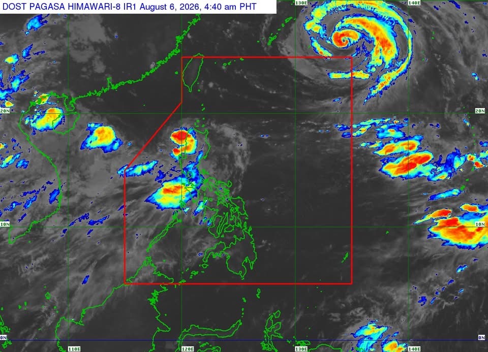
MANILA — Tropical Storm Maymay made landfall in the vicinity of Magsingal, Ilocos Sur early Thursday and is traversing Northern Luzon, prompting the Philippine Atmospheric, Geophysical and Astronomical Services Administration (PAGASA) to maintain Tropical Cyclone Wind Signals over parts of Northern Luzon.
In its 5 a.m. bulletin, PAGASA said the center of Maymay was estimated in the vicinity of San Juan, Ilocos Sur as of 4 a.m.
The storm packs maximum sustained winds of 65 kilometers per hour near the center, gusts of up to 110 kph, and is moving eastward at 10 kph.
Signal No. 2 remains hoisted over Ilocos Norte; the northern and central portions of Ilocos Sur; the western portion of Apayao; Abra; the western portion of Kalinga; and the western portion of Mountain Province, where gale-force winds pose a minor to moderate threat to life and property.
Signal No. 1 is in effect over the rest of Ilocos Sur, La Union, the northern portion of Pangasinan, the rest of Apayao, Kalinga and Mountain Province, Ifugao, Benguet, the southern portion of the Babuyan Islands, Cagayan, Isabela, Quirino, Nueva Vizcaya, and the northern and central portions of Aurora.
PAGASA warned that Maymay, combined with the southwest monsoon, will continue to bring heavy rainfall and strong to gale-force winds over much of the country. Residents in areas vulnerable to flooding, landslides and other rain-related hazards were urged to follow evacuation orders from local authorities.
A gale warning also remains in effect over the western seaboard of Northern Luzon. Very rough seas of up to 5 meters are expected along the coasts of Ilocos Sur, La Union, Pangasinan and the western seaboard of Ilocos Norte, where sea travel is considered risky for all types of vessels.
PAGASA said Maymay is forecast to continue weakening as it crosses the mountainous terrain of Northern and Central Luzon before emerging over the eastern coast of Isabela or Cagayan.
The weather bureau expects the cyclone to weaken into a tropical depression later Thursday morning and possibly degenerate into a remnant low by the afternoon or evening before merging with the circulation of Tropical Cyclone Dolphin.




 Republika News
Leave a comment