
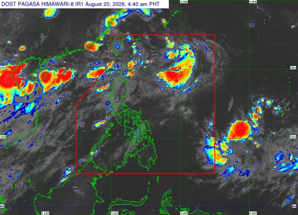
MANILA – Tropical Depression Neneng accelerated Thursday as it moved over the coastal waters of eastern Taiwan, according to the Philippine Atmospheric, Geophysical and Astronomical Services Administration (PAGASA).
In its 5 a.m. Tropical Cyclone Bulletin, PAGASA said Neneng was located 390 kilometers north of Itbayat, Batanes as of 4 a.m.
The tropical depression was packing maximum sustained winds of 45 kph near the center, with gustiness of up to 55 kph and a central pressure of 1004 hPa. It was moving west-northwestward at 30 kph.
Strong winds associated with Neneng extended up to 420 kilometers from its center.
No Tropical Cyclone Wind Signal is currently in effect over any part of the country.
Despite the absence of wind signals, PAGASA warned that the Southwest Monsoon would continue to bring strong to gale-force gusts over much of Luzon and the Visayas, as well as the Zamboanga Peninsula, Northern Mindanao and Davao Region on Thursday.
For Friday, strong to gale-force gusts are forecast over most of Luzon, Panay Island, Negros Occidental, Northern Samar and Davao Oriental. Similar conditions are expected over most of Luzon and the Visayas and Davao Oriental on Saturday.
PAGASA also warned of rough seas in several coastal areas.
Wave heights could reach 3.5 meters along the seaboards of Batanes, the northern and western seaboards of the Babuyan Islands, and the northern seaboard of Ilocos Norte.
Seas of up to 3 meters are forecast along the seaboards of Ilocos Sur, La Union and Zambales, the western seaboard of Pangasinan, the northern seaboard of the Kalayaan Islands, and the remaining seaboard of Ilocos Norte.
Motorbanca operators and those using similarly sized vessels were advised to take precautions and, if possible, avoid sailing under these conditions.
Meanwhile, PAGASA said Neneng is expected to decelerate while moving northward. Its center may continue moving over waters off Taiwan’s eastern coast or make landfall over northern Taiwan.
The tropical cyclone is expected to weaken into a remnant low within the next 12 hours.
PAGASA stressed, however, that heavy rainfall and severe winds may still affect areas outside Neneng’s landfall point and forecast confidence cone, and that the projected track could still shift.
The public and disaster risk reduction and management offices were advised to take necessary precautions and follow instructions from local authorities, particularly in areas highly or very highly susceptible to weather-related hazards.






Leave a comment