
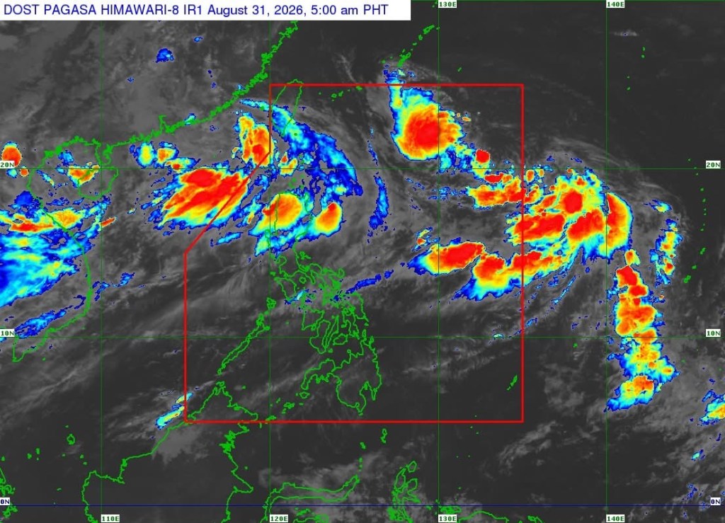
MANILA—Tropical Depression Pilandok slightly intensified while remaining almost stationary over the Philippine Sea east of extreme northern Luzon, the state weather bureau said Monday.
In its 5 a.m. tropical cyclone bulletin, the Philippine Atmospheric, Geophysical and Astronomical Services Administration (PAGASA) said Pilandok was located 1,130 kilometers east of extreme northern Luzon, based on data as of 10 p.m. Sunday.
The tropical depression was packing maximum sustained winds of 55 kilometers per hour near its center, with gustiness of up to 70 kph and a central pressure of 1,000 hectopascals.
Strong winds associated with Pilandok extend outward as far as 450 kilometers from its center.
PAGASA said no Tropical Cyclone Wind Signal (TCWS) is currently in effect.
Pilandok is expected to move generally north-northwestward for most of the forecast period. PAGASA said it is less likely to make landfall and is expected to remain far from the Philippine landmass.
The weather bureau said Pilandok could leave the Philippine Area of Responsibility by Wednesday evening or early Thursday morning, although its forecast track remains highly uncertain and could still change in succeeding bulletins.
The system is expected to maintain its current strength over the next 24 hours and could briefly intensify into a tropical storm by Tuesday afternoon. It is then forecast to weaken back into a tropical depression by Wednesday morning and maintain that strength for the rest of the forecast period.
Despite Pilandok’s distance from the country, PAGASA warned that severe weather could still affect areas outside its forecast confidence cone.
The Southwest Monsoon, meanwhile, is expected to bring strong to gale-force wind gusts over most of the country on Monday, particularly in coastal and upland areas exposed to the winds.
From Tuesday through Wednesday, similar conditions are expected over most of Luzon and the Visayas, as well as Zamboanga del Norte, Misamis Occidental, Lanao del Norte, Misamis Oriental, Camiguin, Dinagat Islands, Davao Occidental, and Davao Oriental.
PAGASA also warned of dangerous sea conditions in several coastal areas.
Waves could reach 4.5 meters along the western seaboard of the Babuyan Islands, where sea travel is considered risky for vessels of all types and sizes. Mariners were advised to remain in port or seek shelter or safe harbor if already at sea until conditions improve.
Waves of up to 4 meters are expected along the seaboards of Batanes and northern Ilocos Sur, the northern seaboard of the Babuyan Islands, and the western seaboard of Ilocos Norte.
Other areas could experience waves of up to 3.5 meters, 3 meters, 2.5 meters, or 2 meters depending on location.
PAGASA advised operators of small seacrafts, including motorbancas, not to venture into the sea under rough conditions, particularly those who are inexperienced or operating ill-equipped vessels.
The agency urged the public and disaster risk reduction and management offices to take necessary measures to protect lives and property and to follow evacuation and other instructions from local authorities in areas vulnerable to hazards.
The next tropical cyclone bulletin is scheduled for release at 11 a.m. Monday.






Leave a Reply