
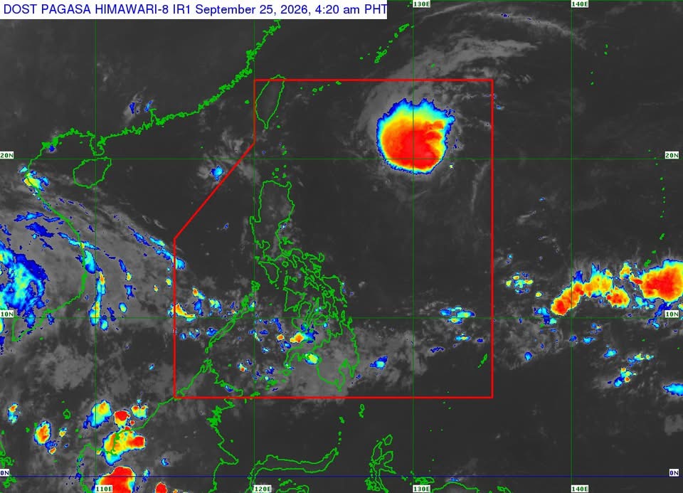
MANILA – Tropical Storm Queenie maintained its strength over the Philippine Sea Friday but is forecast to gradually intensify and could reach typhoon category by Sunday, the Philippine Atmospheric, Geophysical and Astronomical Services Administration (PAGASA) said Friday.
In its 5 a.m. bulletin, PAGASA said Queenie was located 1,065 kilometers east of Extreme Northern Luzon as of 4 a.m., packing maximum sustained winds of 75 kph near the center and gustiness of up to 90 kph.
The storm was moving northwestward at 20 kph, with strong to gale-force winds extending up to 370 kilometers from its center.
No Tropical Cyclone Wind Signal is currently hoisted, and PAGASA said Queenie is unlikely to directly affect the country throughout the forecast period.
The agency said coastal waters are expected to have wave heights of less than 2 meters over the next 24 hours.
Queenie is expected to move west-northwestward until Friday afternoon before shifting northwestward Saturday morning.
By Saturday afternoon, it is forecast to slow down and turn from northwestward to northeastward. PAGASA expects the storm to exit the Philippine Area of Responsibility between Sunday afternoon and early Monday morning.
The tropical cyclone is expected to accelerate northeastward after leaving the PAR.
PAGASA warned that heavy rainfall and severe winds may still occur outside the projected landfall point and forecast confidence cone, and said the storm’s track could still change within the cone.
The agency advised the public and disaster risk reduction and management offices to take necessary measures to protect lives and property and follow evacuation orders and other instructions from local officials.
The next tropical cyclone bulletin will be issued at 11 a.m. Friday.





Leave a comment