
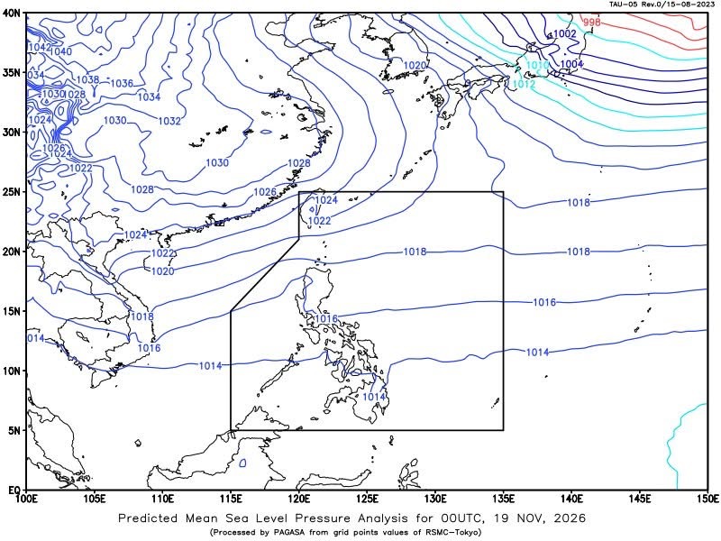
MANILA — Several areas across Luzon, Visayas and Mindanao may experience scattered rains and thunderstorms on Thursday due to the shear line, easterlies and Intertropical Convergence Zone (ITCZ), the state weather bureau said.
In its 4 a.m. forecast, the Philippine Atmospheric, Geophysical and Astronomical Services Administration (PAGASA) said mainland Cagayan and Isabela would have cloudy skies with scattered rains and isolated thunderstorms due to the shear line.
Aurora may also experience cloudy skies with scattered rains and thunderstorms, while Caraga, Davao Region, SOCCSKSARGEN, Leyte and Southern Leyte are expected to have similar conditions due to the ITCZ.
PAGASA warned of possible flash floods or landslides in these areas during moderate to at times heavy rainfall.
The rest of Mindanao, meanwhile, may experience isolated rain showers or thunderstorms, with flash floods or landslides possible during severe thunderstorms.
Metro Manila and the rest of the country will have partly cloudy to cloudy skies with isolated rain showers or thunderstorms due to the easterlies.
Batanes and the Babuyan Islands are forecast to have partly cloudy to cloudy skies with isolated light rains due to the northeast monsoon, with no significant impact expected.
For coastal conditions, moderate to rough seas are expected in extreme Northern Luzon, with northeast winds and waves reaching 1.5 to 3.1 meters.
The rest of the country will have light to moderate winds from the east to northeast, with slight to moderate coastal waters measuring 0.6 to 2.5 meters.
PAGASA recorded temperatures ranging from 22.9°C to 31.8°C and relative humidity levels between 62% and 84% in the 24-hour period ending at 8 p.m. Wednesday.
In Metro Manila, sunrise is at 5:59 a.m. and sunset at 5:24 p.m. Thursday. The moon is expected to rise at 1:15 p.m. and set at 12:42 a.m., with 70% illumination.





Leave a Reply