
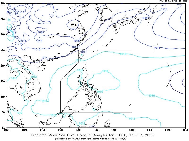
MANILA – Easterlies are expected to bring partly cloudy to cloudy skies with isolated rain showers and thunderstorms over Batanes and the Babuyan Islands on Tuesday, according to the Philippine Atmospheric, Geophysical and Astronomical Services Administration (PAGASA).
PAGASA said the weather conditions may trigger flash floods or landslides in areas affected by severe thunderstorms.
Metro Manila and the rest of the country will likewise experience partly cloudy to cloudy skies with isolated rain showers or thunderstorms, mainly due to localized thunderstorms.
The weather bureau issued the forecast at 4 a.m. Tuesday, Sept. 15.
Tropical depression outside PAR
Meanwhile, a tropical depression was located 2,675 kilometers east of Eastern Visayas as of 3 a.m.
The system, outside the Philippine Area of Responsibility (PAR), was at 12.4°N, 150.0°E, with maximum sustained winds of 55 kilometers per hour near the center and gustiness of up to 70 kph.
It was moving north-northeastward at 15 kph.
Winds, coastal waters
Mindanao will experience light to moderate winds from the southwest to west, with coastal waters expected to range from 0.6 to 2.5 meters.
In extreme Northern Luzon, winds will be light to moderate from the east to northeast, with coastal waters ranging from 1.2 to 2.1 meters.
The rest of the country will have light to moderate winds from the northeast to northwest, while coastal waters will range from 0.6 to 2.1 meters.
In Metro Manila, PAGASA recorded a minimum temperature of 24.7°C at 5 a.m. and a maximum of 32.7°C at 2 p.m. during the 24-hour period ending 8 p.m. Monday.



 Republika News
Leave a comment